


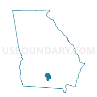
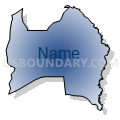
0191148 - UPPER TENTH Voting District, Berrien County, Georgia
About
Outline

Summary
| Unique Area Identifier | 560321 |
| Name | 0191148 - UPPER TENTH Voting District |
| County | Berrien County |
| State | Georgia |
| Area (square miles) | 54.93 |
| Land Area (square miles) | 54.33 |
| Water Area (square miles) | 0.60 |
| % of Land Area | 98.91 |
| % of Water Area | 1.09 |
| Latitude of the Internal Point | 31.26037170 |
| Longtitude of the Internal Point | -83.12750220 |
Maps


Graphs
Select a template below for downloading or customizing gragh for 0191148 - UPPER TENTH Voting District, Berrien County, Georgia


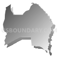
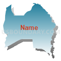


Neighbors
Neighoring Voting District (by Name) Neighboring Voting District on the Map
- 0030003 - WILLACOOCHEE Voting District, Atkinson County, GA
- 0191157 - NASHVILLE Voting District, Berrien County, GA
- 0191767 - LOWER TENTH Voting District, Berrien County, GA
- 019518 - ALAPAHA Voting District, Berrien County, GA
Top 10 Neighboring County Subdivision (by Population) Neighboring County Subdivision on the Map
- Nashville CCD, Berrien County, GA (10,011)
- Willacoochee CCD, Atkinson County, GA (2,077)
- Alapaha CCD, Berrien County, GA (1,828)
Top 10 Neighboring Unified School District (by Population) Neighboring Unified School District on the Map
Top 10 Neighboring State Legislative District Lower Chamber (by Population) Neighboring State Legislative District Lower Chamber on the Map
- State House District 176, GA (56,994)
- State House District 169, GA (51,596)
- State House District 170, GA (51,371)
Top 10 Neighboring State Legislative District Upper Chamber (by Population) Neighboring State Legislative District Upper Chamber on the Map
Top 10 Neighboring 111th Congressional District (by Population) Neighboring 111th Congressional District on the Map
Top 10 Neighboring Census Tract (by Population) Neighboring Census Tract on the Map
- Census Tract 9704, Berrien County, GA (3,368)
- Census Tract 9601, Atkinson County, GA (2,077)
- Census Tract 9701, Berrien County, GA (1,828)